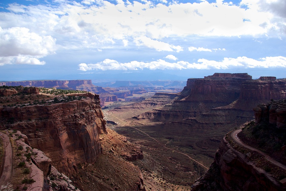
Moving around the desert Southwest, we see a lot of folds. This view is from the Anticline Overlook at Canyonlands National Park. Look up what an anticline is below and then see if you can spot this one. Remember you may only be able to see part of it in the photo. All of the folds (not the basin) pictured below are found in the arid Southwest.
Folds
Rocks deforming plastically under compressive stresses crumple into folds. They do not return to their original shape. If the rocks experience more stress, they may undergo more folding or even fracture.
You can see three types of folds.
Monocline
A monocline is a simple bend in the rock layers so that they are no longer horizontal (see Figurebelow for an example).
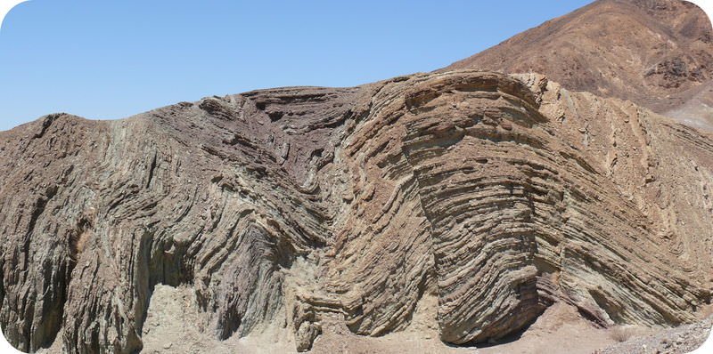
At Utah's Cockscomb, the rocks plunge downward in a monocline.
What you see in the image appears to be a monocline. Are you certain it is a monocline? What else might it be? What would you have to do to figure it out?
Anticline
Anticline: An anticline is a fold that arches upward. The rocks dip away from the center of the fold (Figurebelow). The oldest rocks are at the center of an anticline and the youngest are draped over them.
Anticlines are formations that have folded rocks upward.
When rocks arch upward to form a circular structure, that structure is called a dome. If the top of the dome is sliced off, where are the oldest rocks located?
Syncline
A syncline is a fold that bends downward. The youngest rocks are at the center and the oldest are at the outside (Figurebelow).
(a) Schematic of a syncline. (b) This syncline is in Rainbow Basin, California.
When rocks bend downward in a circular structure, that structure is called a basin (Figurebelow). If the rocks are exposed at the surface, where are the oldest rocks located?
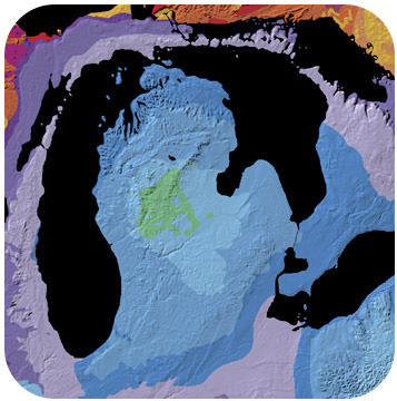
Basins can be enormous. This is a geologic map of the Michigan Basin, which is centered in the state of Michigan but extends into four other states and a Canadian province.
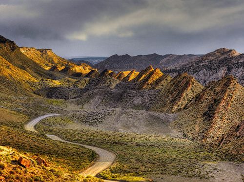
Some folding can be fairly complicated. What do you see in the photo above?
Summary
Rocks deform by compressive stress into folds.
A monocline is a simple bend.
In anticline, rocks arch upward. A three-dimensional anticline is a dome.
In a syncline, rocks arch downward. A three-dimensional syncline is a basin.
Review
Draw a picture to show how compressive stresses lead to the formation of anticlines and synclines.
Do you think that anticlines and synclines are ordinarily found separately or adjacent to each other?
If you found a bulls-eye of rock on the flat ground with no structure to guide you, how could you tell if the structure had been a syncline or an anticline?
What folds can you find in this photo of Monument Valley in Arizona? Notice the rock layers at the top of the ridge. What is the geologic history of this region?
Explore More
Use this resource to answer the questions that follow.
What causes folds?
What are the folds called?
What is dip? What is it measured from?
What is strike?
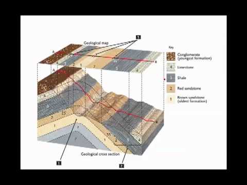
What does a block diagram show you?
What is the strike and dip symbol?
What do the arrows on the diagram tell you?
Describe the effects of erosion on how a rock layer looks on a map.
Vocabulary
termdefinition
anticlinea fold that arches upward; older rocks are in the center and younger rocks are at the outside.
domea circular anticline; oldest rocks are in the center and youngest are on the outside.
folda bend in a set of rocks caused by compression.
monoclinea bend in a set of rocks that causes them to be inclined relative to the horizontal.
synclinea fold in the rocks that bends downward, in which the youngest rocks are at the center.
Notes/Highlights
Color
Highlighted Text
Notes
Please Sign In to create your own Highlights / Notes


 FlexiA FREE Digital Tutor for Every Student
 FlexBooks 2.0Customizable, digital textbooks in a new, interactive platform
 FlexBooksCustomizable, digital textbooks
 SchoolsFlexBooks from schools and districts near you
 Study GuidesQuick review with key information for each concept
 Adaptive PracticeBuilding knowledge at each student’s skill level
 SimulationsInteractive Physics & Chemistry Simulations
 PLIXPlay. Learn. Interact. eXplore.
 CCSS MathConcepts and FlexBooks aligned to Common Core
 NGSSConcepts aligned to Next Generation Science Standards
 Certified EducatorStand out as an educator. Become CK-12 Certified.
 WebinarsLive and archived sessions to learn about CK-12