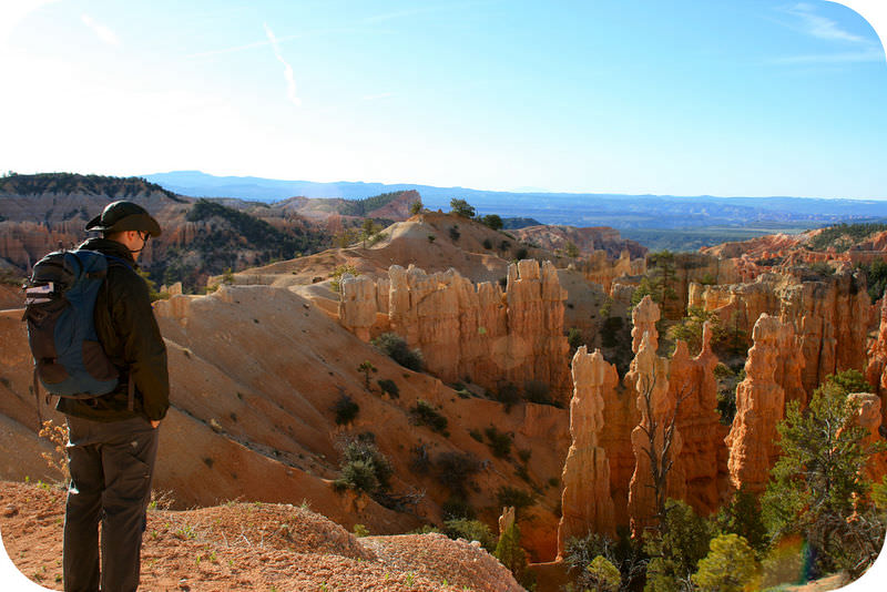
For many geologists, a day hiking in beautiful country to learn more about the interesting geology is about as good as it gets!
Field Work
Many Earth scientists collect data in the field. The data may be from observations or measurements. The scientists may create a geological map of the area, write detailed descriptions, or collect samples to analyze in the lab. Or a combination of all of these! Many Earth science laboratories contain high-tech equipment to reveal the chemistry or age of a rock sample. Field work is done to look for resources, for environmental cleanup, or for any number of other reasons. One common reason is just to understand the region better.
Field Trips
To really understand geology and some of the other branches of Earth science, it's best to go out in the field! Some of the concepts presented here focus on regions where geologically interesting features can be seen. In these cases, a location is presented and the phenomena of interest described. It's just like we're going on a field trip! These field trips are great because they don’t involve long drives in a car, expensive airplane trips, or a passport! We can do things that are difficult or impossible to do on an ordinary field trip. We can go to any single location on Earth, we can hop along a latitude line, visit the bottom of the ocean, or look to different areas for a specific phenomenon.
Of course, we won't be enjoying the fresh air, exercise, camaraderie, or thrill of discovery in the same way we would on a real field trip, but, hey, you can't have everything! What follows is a brief synopsis of some of the places we'll be visiting. Where possible, we've tried to visit locations in the western United States, an area that may be familiar to you.
California
Major geographic features of California.
In the satellite image in the Figureabove, it is possible to identify the major geographic features of California.
The Coast Range runs the length of the state along the Pacific coast. A tremendous amount of rain falls in the northern part of the range, so the region is heavily forested. Further south, rainfall and vegetation are more sparse.
The Central Valley, made up of the Sacramento and San Joaquin river valleys, runs through about half of the central part of the state is located inland from the Coast Range. The collection of river sediments and the abundance of water has made the Central Valley one of the most important agricultural regions in the world.
The Sierra Nevada Mountain range lies east of the Central Valley. In the winter the mountains are covered by snow, but in this image there is little to no snow and the bare rocks of the high peaks are showing, particularly in the southern portion of the range. Yosemite National Park lies within the Sierra Nevada.
East of the Sierra Nevada and into the state of Nevada, the climate is very arid. Death Valley, the driest spot in the United States is found there.
Mt Shasta, at the north end of the Sierra Nevada, is the southernmost remaining volcanic cone in the Cascades Range.
Nevada
East of the image of California is Nevada. Very different from California, Nevada is extremely arid. The Basin and Range province, which consists of a set of mountains and valleys, is best displayed in the state. You can see the ranges as dark brown rocky regions and the valleys as lighter brown. The ranges have been described as worms crawling northward across the state, which is what they look like in this image.
Pacific Northwest
North of California along the Pacific Coast is Oregon, Washington and then British Columbia in Canada. This region is similar to California in having a coastal range, a central valley (at least in part of Oregon) and very arid lands east of the high Cascades mountains.
The Cascades are volcanoes that begin with Lassen in California, run through Oregon and Washington, and continue into British Columbia. Some of them are easily spotted on this image as white spots in the midst of the green forests of the Cascades range.
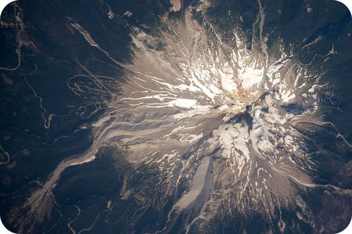
The closeup image of Mount Hood taken by an astronaut on the International Space Station shows one of the most distinctive of the Cascades composite volcanoes. Solidified lava makes up the summit of the mountain and glaciers are found on both the north and south sides of the peak. Mount Hood is the northernmost Cascade volcano in Oregon and is just south of Mt. St. Helens.
Idaho, Montana, Wyoming
This image shows the states of Idaho, Montana, Wyoming, with a little of Utah and a few others. The northern part of Idaho and northwestern Montana is mountainous and forested. Arid lands lie to the east.
Glacier National Park
This satellite image of GNP in summer shows snow-capped peaks and glacial valleys, many of which are now lakes.
Glacier National Park in the northwestern part of Montana reaches to the Canadian border. North of the border the park becomes the Canadian Waterton Lakes National Park. Although Glacier National Park was established in 1910 to preserve the wild lands and wildlife, the glaciers have been reduced by a reduction in precipitation and higher summer temperatures. On glaciers, snowfields, or just rock, Glacier National Park is a fantastic place to see glacial features, beautiful scenery, and wildlife.
Naturalists enjoy the hike to Iceberg Lake in Glacier National Park.
Yellowstone National Park
Grand Prismatic Spring is one of the spectacular features of Yellowstone National Park.
Yellowstone National Park is in the northwestern corner of Wyoming. Although Yellowstone is best known for its incredible geysers, the park also has gorgeous mountain scenery and fantastic wildlife, including herds of amazing bison. The best known feature is Old Faithful, a geyser that's not the highest, largest, or most beautiful, but is the most reliable.
Bison are just some of the amazing creatures that roam around Yellowstone.
Southwest
The Southwest is home to mountains, canyons, valleys, and flat lands. Many features discussed in the Earth Science concepts can be seen in the Southwest.
The Southwestern United States is a great place to study geology. The region is so arid that in most locations rocks and structures are easily seen. In several concepts we will visit parts of the Southwest to view geology in the field.
Grand Canyon
From the rim, the Grand Canyon gives a sense of the vastness of geologic time and the immensity of the planet.
Geologists say that the Grand Canyon has "layer cake geology" because the rock strata are so easy to see. Sedimentary rocks are like a book that tells of the environment in which they formed. Rock units can be traced across large expanses. Looking down into the Grand Canyon, you get a sense of the vastness of space and of time.
Hawaiian Islands
The Hawaiian Islands from space.
The Hawaiian Islands are in the central Pacific Ocean, a land of sun, exotic life, and volcanoes. The islands increase in age from the Big Island of Hawaii at the southeast end of the chain through Maui, Kahoolawe, Lanai, Molokai, Oahu, Kauai, and Niihau Islands through the northwest. Kilauea volcano on Hawaii has been erupting almost continuously since 1983 and eruptions are also going on at an underwater volcano called Loihi seamount. Hawaii is a fantastic place to see volcanic eruptions and features.
Summary
Earth scientists learn about many aspects of their disciplines by going out into the field.
Field trips are an important part of the education of a geology student.
The western United States is a great place to see examples of many types of geological phenomena.
Review
How does the geography of Oregon parallel the geography of California?
Where are the arid lands in the western United States and why are they important for understanding geology?
How do the satellite images of the western United States give you a sense of space and time?
Notes/Highlights
Color
Highlighted Text
Notes
Please Sign In to create your own Highlights / Notes
Credit:Courtesy of Jesse Allen, Earth Observatory, using data obtained courtesy of the University of Maryland’s Global Land Cover Facility Source:http://visibleearth.nasa.gov/view.php?id=6399 License:Public Domain
Credit:Miles Orchinik Source: CK-12 Foundation License:CC BY-NC 3.0
Credit:Miles Orchinik Source: CK-12 Foundation License:CC BY-NC 3.0


 FlexiA FREE Digital Tutor for Every Student
 FlexBooks 2.0Customizable, digital textbooks in a new, interactive platform
 FlexBooksCustomizable, digital textbooks
 SchoolsFlexBooks from schools and districts near you
 Study GuidesQuick review with key information for each concept
 Adaptive PracticeBuilding knowledge at each student’s skill level
 SimulationsInteractive Physics & Chemistry Simulations
 PLIXPlay. Learn. Interact. eXplore.
 CCSS MathConcepts and FlexBooks aligned to Common Core
 NGSSConcepts aligned to Next Generation Science Standards
 Certified EducatorStand out as an educator. Become CK-12 Certified.
 WebinarsLive and archived sessions to learn about CK-12